Cheers,
Spring is playing hide and seek with us this past week. Today has been gray and windy one minute; warm and sunny the next. Seems to me that we grew up with the phrase, “if you don’t like the weather, wait a minute.” So maybe New England and Old England have much in common. The forecast is for rain for this coming week I guess to bring those May flowers.
I’ve become fascinated with the history of this dock area. Thanks to the very helpful Tourist Office ladies I have a Waterfront walking tour pamphlet and one for the town center. I’m hoping to do the town center before we leave though time is too quickly passing.
Ru
|
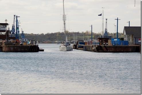
After our visit to the Jewish Cemetery we walked back to the waterfront and strolled along Orwell Quay and Eagle Wharf towards the “new 1882 lock.” Eventually we had to leave the river and turn left and then because I wanted to see what the “interesting old building was’ we turned right which took us to Cliff Road and the Brewery Tap. |
|
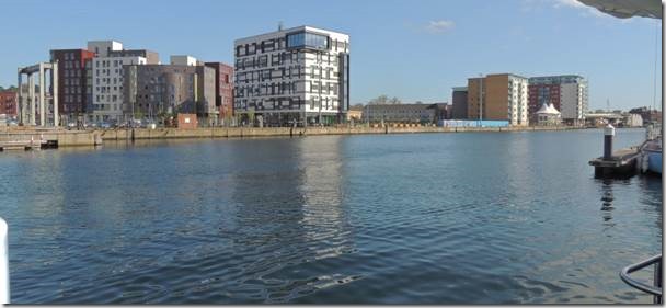
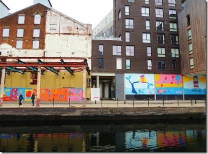
Our walk was across the river along the Orwell Quay past “modern” Ipswich which I don’t find particularly attractive. I believe these buildings are part of the University Suffolk Campus. It sort of reminds me of a bar code. This photo was taken from our swim platform and you can see a bit off our dinghy in the top right corner. By the end of the photo we had to leave the waterfront and that’s when we found “The Brewery Tap.” |
|
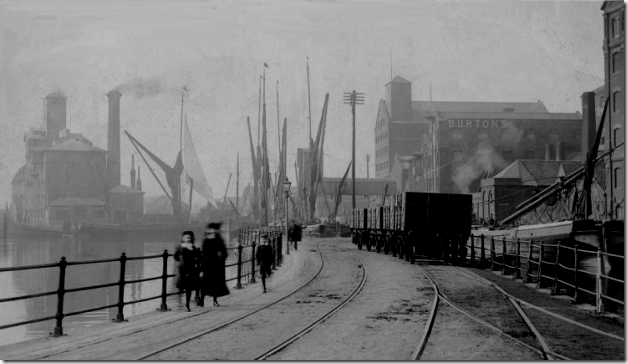
For historic images http://www.ipswichmaritimetrust.org.uk/pdfs/IMTOccasionalPaperNo1.pdf is a wonderful and short history of the historic docks area. More importantly it shows maps of all the different private and public quays and wharfs that lined the Wet Docks area. The website below also has wonderful old photos of the wharf area and the quays and docks. |
|
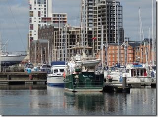
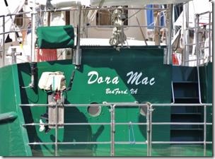
Looking across at DoraMac from the Orwell Quay : see her new legible lettering thanks to Randal |
|
At high tide the lock stays open and you can just cruise through rather than having to tie up so the lock can adjust the water level into and out of the basin. The water in the basin is always at high tide to keep the boats in the basin from sitting in mud or falling over during low tide. |
|
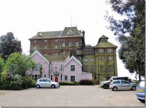
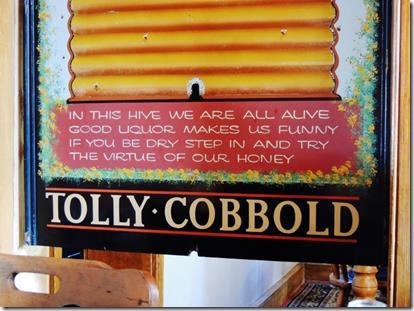
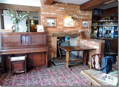
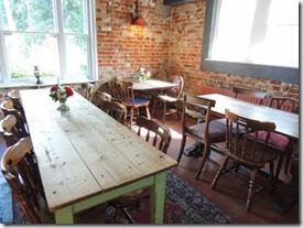
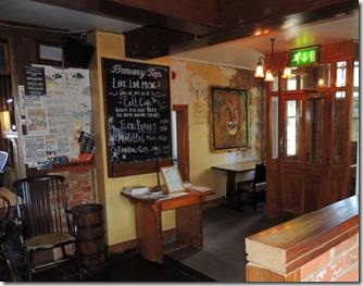
So we found the Brewery Tap Pub next to the Old Tolly Cobbold Brewery |
|
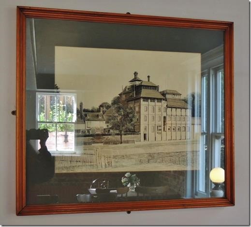
Old photo of the Brewery with the Brew Master’s house next door. Tolly Cobbold’s Cliff Quay Brewery |
|
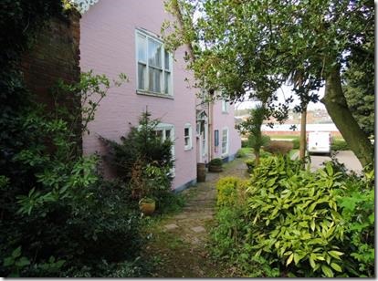
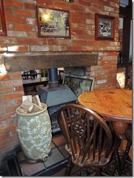
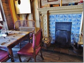
‘The Old Brewer’s House’ Also called (by some): ‘The Old Brewmaster’s Cottage’ or ‘The Head Brewer’s House’. Richard Toller, who lived in this house 1896-1922, has the nearby Toller Road named after him. Although scant on lettering, the Cliff Quay brewery is an interesting and melancholy site for the town, with its huge decaying tower brewery building and this rather fine house nearby giving a hint of the past glories of Tolly Cobbold’s. We recall that this house was used as offices for the brewery business. http://ipswich-lettering.org/tollyhouse.html has photos of its rather derelict days before it was refurbished as a pub. Today the Brewery Tap and the old derelict brewery behind it. We saw some folks inside eating and there were lots of tables, but we still weren’t sure it was a restaurant as the signage wasn’t so obvious. |
|
We walked around not knowing if it was a restaurant or if it was open. But a very nice man saw our dilemma and assured us they were open. He knocked on the door, went in and asked if they were still serving as it was just at the end of breakfast and before lunch. They were still making breakfast so we went in. Randal had “American” pancakes and I had the best scrambled eggs ever. And the tea came in a big pot not a tea bag in a cup. |
|
Tolly-Cobbold Brewery heritage |
|
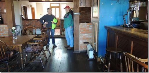
Randal speaking with Andrew Vass who had led our way into the restaurant. I asked the staff who the man was who’d helped us and was told he was an artist. She spelled his last name….VASS but I heard Bass. I had no luck searching Andrew Bass so asked the ladies at the Tourist Information building to help. She promptly got on the phone and called the Brewery Tap and was told the correct spelling. Very helpful people at the Tourist Office! |
|
http://thebrewerytap.org/ website for The Brewery Tap http://www.tollycobbold.co.uk/cliffbrewery.htm for the history of the brewery |
|
Founded 1723 in Harwich, by John Cobbold and his family. Brewing was moved to Cliff Quay in Ipswich by 1746, which made life much easier, since for a while the brewing water was being shipped from Holy Wells park (in Ipswich) down the River Orwell by boat whilst the finished beer was increasingly being shipped back to the town. Today, most of the remaining buildings at the Cliff Quay brewing site date mainly from about 1895 when the site was considerably redeveloped and enlarged, although a few parts are much older. The buildings from this time were designed by William Bradford. When the Cobbold family celebrated their bi-centenary of brewing in 1923, they listed eight generations of the family who had already been involved with running this highly successful family business and the future looked assured with a large local estate of nearly 300 pubs. Most beer production throughout this very long and successful brewing period was of Mild and Porter – two traditional dark beer types – but tastes were changing and there was an increasing demand for lighter coloured and more bitter beer styles. The brewery was also refurbished in the mi-1950s when a large extension (recently demolished) was built to the rear of the main Victorian brewery building. Some of the Cobbold brewery beers then also won prizes, including the famous Cobbold’s Cobnut Brown Ale which was also exported to the US. The Cobbold brewery also employed some of the ITFC professional footballers as draymen in the summer months to help suppliment their income, including Ozzie Parry (played from 1936-49) and George McLucky (played from 1933-38). By 1959 the family brewery had become involved in a business merger with their long time local rival company, Tollemache Brewery. The resultant Tolly Cobbold company was also based at Cliff Quay and traded under various owners until 2002. ……. Jump to 2005 After several years of neglect the old brewery buildings at Cliff Quay are currently being rationalised in anticipation of new business use. The new microbrewery was removed. The main pub estate was broken-up and sold on separately by the holding banks in 1991 (much of it was to became part of the Pubmaster estate and then later part of Punch Taverns). The adjacent Brewery Tap is now free of tie. Whilst a new (second) microbrewery is now located in a relatively small part of the historic site called Cliff Quay brewery. |
|
http://www.cliffquay.co.uk/about-us/ is about the microbrewery that is now using part of the building that was once the old brewery ……………………………………….. |
|
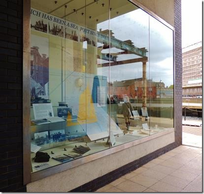
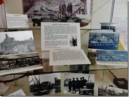
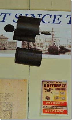
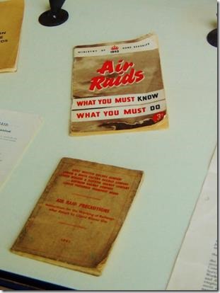
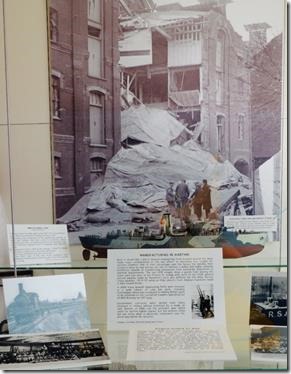
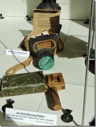
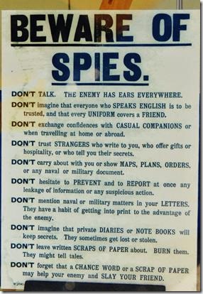
While walking back from the Theta Café and UCS Gallery, I came across the Ipswich Maritime Trust “Window Museum.” Down the small alleyway is the Ipswich Maritime Trust Window Museum Ipswich during the War Years is the current subject of the Window Museum which has a rotating display. There is more Ipswich history in the local museum which I now must visit! |
|
Rosie the Riveter Ipswich |
|
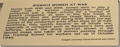
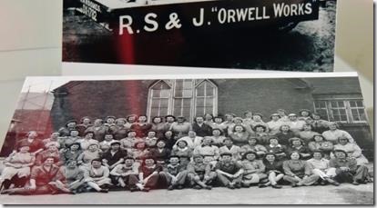
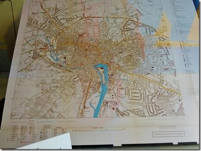
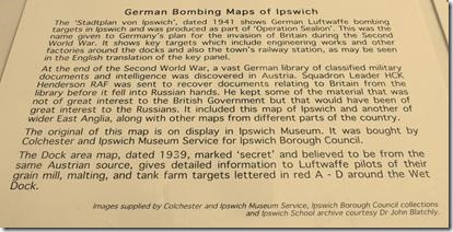
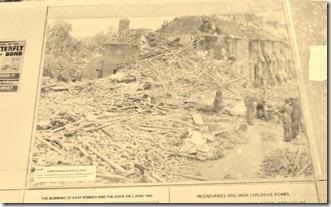
When Ipswich was the target of enemy bombers : New Ipswich docks in wartime historical window display David Vincent Thursday, November 14, 2013 Trust director Stuart Grimwade said: “The Ipswich docks and engineering firms were important targets for German bombers in World War 2 and were also a target in the 1914-18 War. “We are putting together our next Waterfront Museum Window looking at Ipswich docks in wartime.” I met up with Stuart and Des Pawson of the Ipswich Maritime Trust at BMS Imaging off Wherstead Road, where Roger Barcham has produced giant copies of Second World War bombing photographs and German maps which included important targets The Riverside Industrial Estate is on the site of the former Cocksedges engineering works where the workers made Bofors guns which were then mounted on converted trawlers operating out of HMS Bunting on Cliff Quay. This latest display has been put together with the help of the Colchester and Ipswich Museums Service. The new display, which will stay for six months, will include copies of maps, posters and various period artifacts about Ipswich in wartime. They include copes of German Bombing Maps of Ipswich which were discovered after the 1939-45 War. The ‘Stadtplan von Ipswich’, dated 1941 shows German Luftwaffe bombing targets in Ipswich and was produced as part of ‘Operation Sealion’ invasion plans. The original of this map is on display in Ipswich Museum. The Dock area map, dated 1939, and marked ‘secret’ gives detailed information to Luftwaffe pilots of their grain mill, malting, and tank farm targets lettered in red A – D around the Wet Dock. Many Ipswich firms were involved in vital war work. Both in World War I and II, Ipswich engineering firms located around the dock made major contributions to the war effort, so becoming key targets for German bombers. One of their advantages was the facility for sending their products away by sea and by rail, not to mention a skilled and highly versatile workforce capable of transforming production from peacetime to wartime requirements. Government contracts were spread over many locations to reduce serious knockout by a single air raid. Women at RS&J cut the precision gear wheel teeth for Spitfire fighter planes, but the workers often did not know what a particular component was for, which was better for security. Photographs in the display show the aftermath of a raid on the Paul’s silo at Ipswich Docks and the damage caused by bombs dropped on Bishop’s Hill, by Fockewolf 190 in 1943 and bounced downhill before exploding. Houses in Myrtle Road were destroyed and seven people died. The German bomber crashed and the engine ended up on the Ransome and Rapier site on the other side of the docks. The propeller was later recovered. Des Pawson added: “The tragedy of war was also demonstrated by the fact that pilot died. He was only 20 and he was somebody’s son as well.” |

