Hotel Dustra
Silistra, Bulgaria
добър ден dobŭr den Good Afternoon
Randal and I explored a little of Silistra this morning, one place being the Art Museum which was WONDERFUL. Price of admission was 1 lev = $.68. The catalogue of the permanent collection with English text as well as Bulgarian text was 5 lev. I took a bunch of photos of the current exhibition which I’ll share when I write about Silistra.
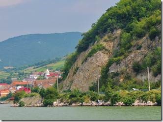
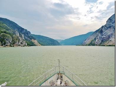
This email is about our passage along through the gorges of the Danube to Iron Gate. Really dramatic scenery.
Ru
From its headwaters in Germany’s Black Forest, the Danube winds its way through ten European countries to drain into the Black Sea. For much of its course, the river moves lazily through wide valleys, but as it enters the border region between Romania and Serbia, its banks narrow into a series of high cliffs. Here, the river carved a passage through the lower Carpathian Mountains to its north and the Balkan Mountains to its south, creating a series of four steep gorges. These gorges are known as the Iron Gate. Within the last of the four gorges is the Danube’s second iron gate: the Iron Gate Dam. Both of the Danube’s Iron Gates—the lower gorges and the dam—are shown in this image, taken by the Advanced Spaceborne Thermal Emission and Reflection Radiometer (ASTER) on NASA’s Terra satellite.
Much of the image is red, where plants and trees cover the land. Tan rocky outcrops snake along mountain tops too high in altitude to support trees and emerge in the steep cliffs that line the river. Signs of human habitation are visible, too; the silver area on the north shore of the river is the Romanian town of Orsova.
The Danube cuts a wide, blue ribbon through the center of the image. The river’s narrowest point as it passes through the gorges is at Great Kazan gorge, shown on the left side of the image. Within the gorge, the Danube shrinks to 150 meters in width and is flanked by limestone cliffs that reach to about 300 meters. The cliffs are a darker shade of red on the east bank of the river and are accented with dark shadows. After exiting the gorge, the river widens again as it enters the Orsova Valley. A “u” bend brings the Danube into the last gorge, the Sip Gorge. Though the land’s wrinkled appearance suggests rugged terrain, the cliffs here are not nearly as severe as in the Kazan gorge.
The Danube is a major waterway for international trade, but the Iron Gate gorges created rapids and whirlpools that made navigation difficult. Control over this section of the Danube was gained with the construction of the Iron Gate Dam in the Sip Gorge. The dam, the white line across the river on the right side of the image, began operation in 1972. As the Danube deepened behind the dam, its expanding waters covered at least seven towns, including old Orsova and the island town of Ada Kaleh, a Turkish enclave.
Apart from Orsova and a few very small towns, which form tiny silver dots on the north shore of the river, the region is notably free of signs of human habitation west of the Iron Gate Dam. The square grids of vegetation created by agriculture are missing, as are sprawling silver cities. The land on both sides of the river is protected. Djerdap National Park lines the south shore of the river in Serbia, and Portile de Fier National Park forms the Romanian shore in the north. Both parks protect the natural environment as well as significant cultural and historical sites ranging from Neolithic settlements to a medieval fortress.
http://earthobservatory.nasa.gov/IOTD/view.php?id=6819
The Djerdap National Park is the largest national park and one of the most popular tourist destinations in Serbia. It was established in 1974 to protect and improve the unique natural and cultural values of the area.
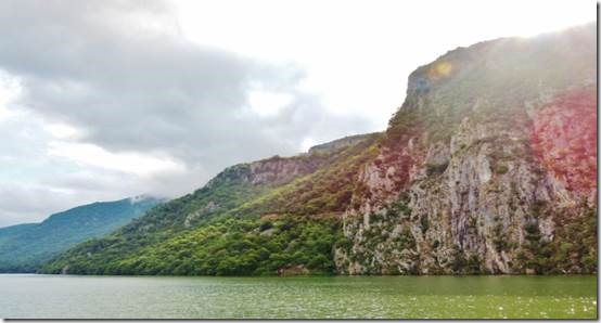
The Djerdap National Park stretches along the right bank of the Danube River, spreading over 640 square kilometres. The Danube forms a huge part of the Djerdap National Park. The main attraction of the Djerdap National Park is the Djerdap gorge – the famous Iron Gate – the dramatic gateway of the Danube through the Carpathian mountains. At 100 km, this is the longest gorge in Europe. The cliffs of the canyon here are 300 meters high while the riverbed in this part is narrowed down to 150 meters.
The territory of the national park is filled with a series of other important features: abundant animal and especially plant life, attractive surroundings and landscapes, including a lake formed by the building of the hydroelectric power plant "Djerdap" (Iron Gates).
http://danube.panda.org/wwf/web/search/details.jsp?pid=13
|
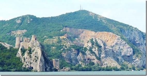
Golubac Castle It is situated in one of the most beautiful parts of the Balkans where the Danube is the widest and nature is the greenest. It is believed to have been built in the early 13th century as a border stronghold of strategic importance. It consists of irregularly shaped narrow walls that connect nine massive towers. Octagonal Hat Tower, formerly used as a pier of the Fortress, nowadays is the symbol and trademark of Golubac. Archaeological research revealed over a hundred ceramic artefacts, iron tools, axes, scraping irons, pick axes, door latches and spears, which are proof of the rich past of the Golubac fortress. There are many interesting legends about the origin of fortress name. According to one of them, once upon a time, a gorgeous princess Golubana lived in a palace. She had refused Turkish pasha’s love and thus was chained to Baba Kaj rock and left to die. After pasha’s screams: “Babo, pokaj se” (“Women, repent”), the rock was called “Baba Kaj” and town was named Golubac after Golubana. With the aid of strong chains, town was connected to Baba Kaj rock allowing total regulation of water and road traffic through Iron Gate. Golubac fortress is under protection of the National Institute for Protection of Cultural Monuments since 1948 and in 1979, it has been categorized as the cultural heritage of exceptional importance. |
|
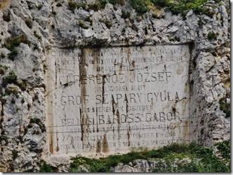
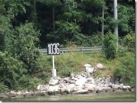
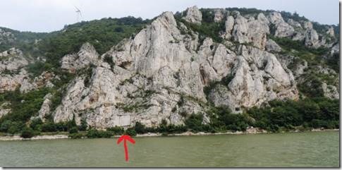
“Along the Golubac Klissura or Gorge (km 1040-km 1026) a plaque at km 1036 commemorates Baross Gabor. As Hungarian minister of transport from 1886 to 1892 he introduced the necessary adjustments for the dangerous Danube rapids. “ |
|
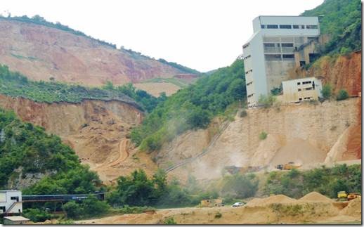
Not all of the landscape along the way is protected |
|
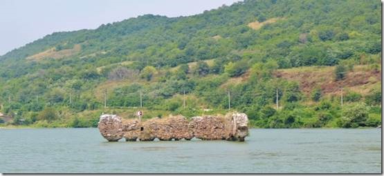
Km 1016 The fortress (ruins partly visible in the middle of the river) was built by Hungarian Kingdom in 15th century. It was flooded by the Iron Gates I Dam’s waters |
|
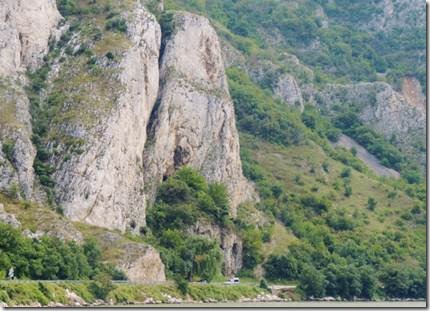
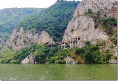
Tunel through the mountain |
|
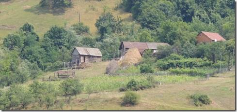
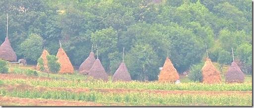
A fairytale farm Teepee shaped haystacks |
|
Our overnight stop was Poreka Reka where we anchored for a quiet night away from noise, music, bright yacht club/restaurant security lights… “Porecka Reka rural property for rent 113 Porečka Reka rural tourism Donji Milanovac – PANACOMP rural property for rent 113 Should you seek for the pure nature, birds’ songs and peaceful ambiance, this is the best choice for you : the house is located in the Porec River Bay, close to the Danube waterway and the beautiful river beach, 2 km far from Donji Milanovac. The house enables full privacy and comfortable vacations providing accommodation on two floors. There is one three-bed apartment with equipped kitchen and additional bed, bathroom and the balcony over the Porec River Bay. The second apartment includes two bedrooms with two beds each, equipped kitchen, a bathroom and the balcony overlooking the Danube River. The house is surrounded with broad garden full of greenery comprising the place for grill and cooking facilities for unbeatable fish-soup of freshly caught fish. Places of interest : Rajko’s Cave, Lepenski Vir archaeological site, Djerdap National Park, Veliki and Mali Kazan/ Great and Small Basin/, "Hajducka vodenica" natural oasis, Golubac Fortress, Vratna Canyon, Danube Iron Gate. “ http://panacomp.net/ Randal washing down the chain and anchor which was covered with thick mud |
|
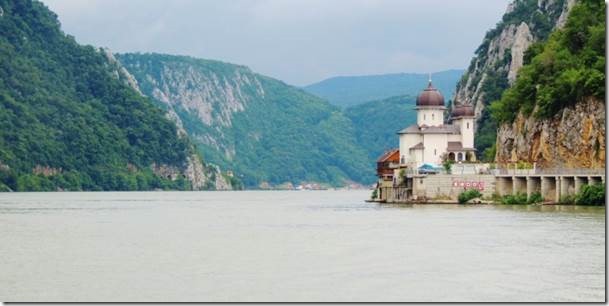
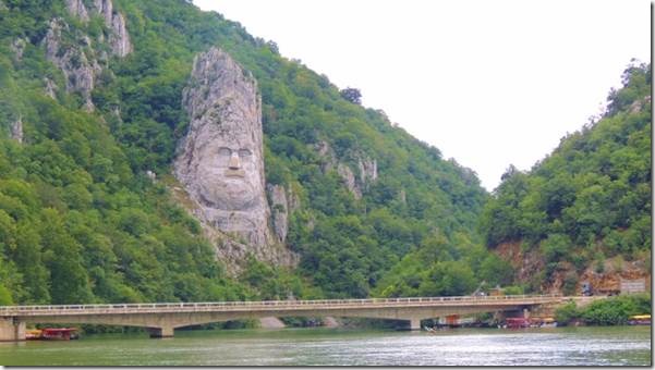
Km 967 Mraconia Church “In western Romania there is a place where the Danube cuts a beautiful gorge into the mountains as it crosses into the country. The area is called Cazane, which means The Cauldrons, and it is the site of the huge hydroelectric plant called The Iron Gates I. The plant was built in the 1960s, and is right now the biggest hydro power plant on the Danube. Building it has taken a lot of sacrifices: the geography was changed and many communities wiped out. The best-known example is Ada Kaleh, an island surrounded by the waters of the river, inhabited by a flourishing Turkish community, which was forcibly evacuated from the now underwater island. Another building which was swallowed by the rising waters was an old monastery called Mracunia. Now a new monastery stands not very far from the original site bearing a variation of this name, Mraconia. It lies 15 km away from the town of Orsova. Father Viorel Vladucu, a spokesman for the Severin and Strehaia Bishopric, told us about the history of the place and the new monastery. Father Viorel Vladucu: “Mraconia, or Mraciunea, means ‘secret place’. It has had a troubled history, being plundered by invaders and having to pay tribute to foreign rulers before its final demise when it was covered by the water. It was destroyed during the Russian-Turkish-Austrian war of 1787-1792, rebuilt, and once again razed in 1968. Even though this place of worship has been destroyed several times along the centuries, we now find it once again, and it is beautiful. In 1967, as the Iron Gates hydro plant started being built, the old place was demolished, and its ruins are now covered by the Danube. As the monastery could not be built in the same place, after 1989 the Metropolitan Bishopric of Oltenia took the initiative of restoring it in a new location.” The old monastery was first mentioned in historical records in 1452, the year of the fall of Constantinople, when the monks of Mracunia took refuge in Orsova, as mentioned in a chronicle of the time. The church was subordinated to the bishopric of Varset in 1523 by Nicola Garlisteanu, the governor of the border region of Caransebes and Lugoj. Father Viorel Vladucu: “The church at that time was dedicated to St. Elijah and chronicler Nicolae Stoica of Hateg wrote in a chronicle dated 1829 that fleeing Turks, after the unsuccessful battle in Varna and after the fall of Constantinople, the monks of Mraconia had taken refuge in Orsova. The monastery decayed in time, but it was still inhabited in 1788 and its interior plaster was still visible around 1800. In 1823 they found among its ruins the stamp seal of the old church with an interesting inscription in Slavonic. Another interesting discovery was made in 1835 when an icon of the Virgin Mary was found, which was later displayed in an exhibition in Vienna by a painter from Munich. The first plans to rebuild the monastery date back to 1931, but the works did not start until 1947.” This time, the new monastery only lasted for 20 years. However, in 1995, the Bishopric of Oltenia made the decision to rebuild the monastery close to its original site. Located on a cliff close to the Cazane gorges on the Danube, the church was very difficult to reach in the past. Things have changed in recent years, as father Viorel Vladucu explains. Father Viorel Vladucu: “While access to the church was very difficult in the past, now there is a road linking Orsova to Moldova Noua, a picturesque road running along the Danube, so many pilgrims can now visit this place easily. A large number of pilgrims have been coming to the church in recent years, also because the Cazane gorges is one of the most beautiful places in Romania. Besides, Mraconia Monastery today lies on the site of a former observation and guiding post, from where navigation on the Danube used to be monitored. The strait is very narrow allowing for the passing of only one ship at a time.” Several tourist sites are close to Mraconia Monastery, such as the statue of Dacian king Decebalus carved in stone, as well as an inscription reading TABULA TRAIANA, which is actually on the Serbian bank of the river, reminding of a time in ancient history when the invading Roman troops crossed the Danube on their way to the former kingdom of Dacia. http://www.rri.ro/en_gb/the_mraconia_monastery-16542 km 967 Decebalus Head at Mraconia – The Romanian Mount Rushmore “If your steps take you to Mraconia, about 15 km West of Orsova, be sure not to miss Decebalus’ head, considered to be the tallest sculpture in Europe. It is carved directly into stone and it represents the last king of the Dacians, the indigenous people that lived in the territory of modern Romania before it was conquered by the Romans, and one of the forefathers of this nation. Decebalus’ head stands 55 m tall and, inevitably, reminds of the famous Mount Rushmore from the United States of America. The eyes are 4.3 m long, the nose is 7 m long and 4 meters wide. This dimensions and its almost inaccessible position are arguments why so many people come to admire it every year. Some calculations reveal that it is only 6 m shorter that the Statue of Liberty and 8 m taller than Jesus’ statue from Rio de Janeiro. The place of the statue was not accidentally chosen, because on the other side of the Danube, on the Serbian shore there is an ancient inscription, carved in stone, named “Tabula Traiana”, celebrating the Roman’s army march against the Dacians and emperor Trajan’s victory against king Decebalus in 105 A.D. This section of the Danube’s course, called Cazane (between Dubova and Ogradena, including, of course, Mraconia) was always considered one of the most dangerous and spectacular. Dangerous because the river’s crossing between the mountains caused the appearance of water swirls that had claimed many sailor lives, spectacular because the landscapes and the experience of fighting the waves are truly breathtaking. Mraconia itself is a testimony as the name can be translated as ”hidden place”, or ”dark waters”. Just as the monument from the USA, Decebalus’ head dates from modern times, extremely recent actually. The initiator of this project was Iosif Constantin Dragan (1917 – 2008), a wealthy Romanian businessman, who was very much in love with the Tracian and Dacian civilizations and who wrote a couple of books about them, asserting that their role in universal history was more important than that from the official versions. His ideas are still controversial, but no one can deny that investing more than a million Euros to realize Decebalus’ head was an extraordinary gift to the Romanian people. Of course, he had to take as much the credit as it can be for this – at the base of the monument it is carved `Dragan Fecit – Dragan made it`. He had also promised to the mayor of Cluj that he will build an identical replica of the Column of Trajan from Rome, that depicts the story of the war between Dacians and Romans. His death in 2008 left this promise unfulfilled. The sculpture was executed between 1994 and 2004, by a team of 12 men, led by the Romanian sculptor Florin Cotarcea. As a comparison, Mount Rushmore took 14 years (1927 – 1941) and 300 men, until it was revealed to the public. The rock where Decebalus’ head stands now is a place only accessible by boat. Dynamite was indispensable and not very sophisticated eqiupments could be used, and they were carried to the top by foot, in bags of almost 50 kg each. The climbing sculptors worked in two shifts every day, from March until October every year and had to face the incredible heat of the summer, the danger of falling into the deepest waters of the Danube and the menace of the vipers. One worker was bit by such a creature one day, but was immediately taken care of. Decebalus’ nose was the trickiest part of the project, as one big piece of rock fell apart, and the Dacian kings’ nostrils had to be straightened with iron armature and concrete. |
|
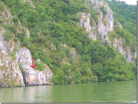
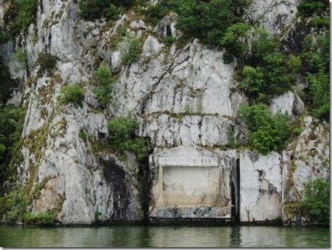
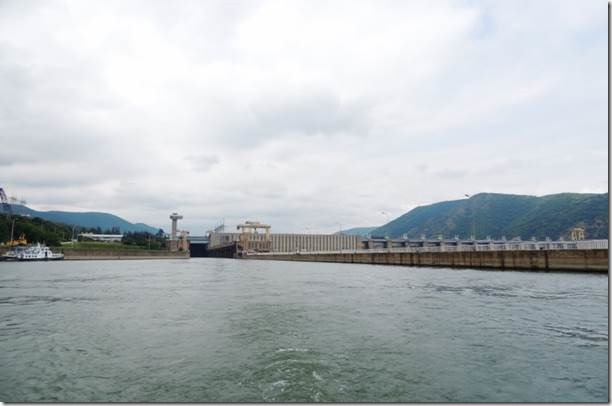
km 965 Tabula Trajana http://www.panacomp.net/tour-packages?mesto=srbija_tabula%20traiana “On the right bank, look out for the weathered marble Trajan’s Plaque (km 965) set here in AD 101 in honour of the Roman emperor. In a few unpretentious words, it commemorates the construction of Trajan’s Road along the Danube, a great feat for the time. The plaque was actually moved a little further up the bank from its original position when the reservoir was built.” JPMM Danube Guide We went through a double chambered lock here at the big dam Abstract The Djerdap 1 and Djerdap 2 Hydro Power and Navigation System (HPNS), also known as the Iron Gate HPNS, are among the largest in Europe. Its purpose is to utilize the considerable hydropower potential and improve the conditions for navigation in the formerly very dangerous section of the Danube. During operation period HPNS has completely fulfilled its intended purpose. The average hydropower production per year is 13 TWh, and covers an important share of power demand in Serbia and Romania. Also, a permanent solution to the centuries-long problem of navigation along the Iron Gate stretch of the Danube River is provided. The Iron Gate HPNS generated considerable modifications of the natural river regime and raised a number of questions concerning water management decisions, such as: the reduced sediment transport capacity, followed by sediment deposition; the raising of the groundwater table, the endangerment of many communities and industrial, municipal and transportation facilities, as well as agricultural production in the riparian belt; the inadequacy of the existing flood control structures; the decrease of the ice transport capacity at the end of the backwater zone; etc. Over 40 years of system operation, most of the initially recognized water management problems were addressed by comprehensive protection works and measures. The environmental impacts and effects of the protection measures were investigated within the scope of a multidisciplinary and complex monitoring program, conducted by Jaroslav Cerni Institute. It is composed of 9 sub-programs, which thoroughly investigate all the possible river impoundment impacts and consequences for the social situation and the environment. This paper gives an overview of the activities and results of the Iron Gate HPNS monitoring, carried out by Jaroslav Cerni Institute on behalf of the Iron Gate Company, between 1974 and 2012. http://www.wrmjournal.com/ |


