May 29, 2014 (15 years today for Randal and me!)
The Main River (pronounced mine) with one more lock to go today, Right Now!
Germany
Since we left Ehrenbreitstein/Koblenz we’ve stopped at St Goar and Bingen, both charming places. We hope to spend tonight in Frankfurt.
But now to prepare for the lock.
Ru
The Romantic Rhine (Middle Rhine)
area Koblenz – Bingen. This section of the Rhine passes through heavily wooded valleys and vineyards clinging to the steep slopes. The road runs along the river on both sides with charming townships along the way. There are no bridges for some distance above Koblenz but car and passenger ferries are frequent and well marked.
The Rhine has always been a great commercial highway. For example about half the timber used in Holland came down the river in vast rafts or flüßels. In mediaeval times the Middle Rhine was largely controlled by the great landowners on either bank. They charged tolls of the trading vessels, and were prepared to use force to back up their demands. Their castles appear at every turn of the river and give the Middle Rhine its romantic appearance today.
http://www.tradboat2.co.uk/sourcepages/rhineships/rhineships.htm
Koblenz: the German Corner and a national heirloom.
At the famous Deutsches Eck, or German Corner, where the Rhine and Moselle converge, lies one of Germany’s oldest and most beautiful towns – Koblenz. Vineyards, forests and four mountain ranges form the backdrop to the city, whose 2,000-year history has given rise to beautiful churches and castles, palatial residences and grand town houses.
The Romans, and later the Teutonic Order, were among the first to prize the majestic scenery of the Upper Middle Rhine Valley. More recently UNESCO has recognised the area’s outstanding beauty by awarding it world heritage status. ……. Just beyond the fortress lies the site of the 2011 Federal Horticultural Exhibition, now a popular public park and outdoor venue. The cable car built especially for the show is still in operation, transporting visitors back to the western bank of the Rhine – the perfect place to begin a leisurely stroll through the beautiful old quarter.
French joie de vivre and German tradition have produced a truly unique cultural fusion in Koblenz, characterized by cozy wine taverns, a genuinely welcoming atmosphere and great food – from gourmet cuisine to hearty fare. People come to Koblenz from all over the world to soak up this charm amid the narrow lanes, tucked-away corners and delightful city squares. A stroll through the old quarter could begin at the four towers, as the oriels of four baroque houses are known – one on each corner of the area’s main street crossing. At the Hauptwache guardhouse from 1689, guns, flags, muskets and horns serve as a reminder of the soldiers who carried out police duties here. Further along is the Schängel fountain, which stands in the courtyard of the town hall. This famous landmark harks back to the time around 1800, when Koblenz belonged to France and a conspicuously large number of boys were christened Jean – which became Schang and then Schängel in the local dialect. We can only assume that some of these boys must have been rascals, because at irregular intervals the figure in the fountain spits out a powerful stream of water onto unsuspecting passers-by! The Deutscher Kaiser is also worth a visit. This is not another monument as its name might suggest, but a Gothic tower house that now boasts a delightful restaurant on the ground floor. It’s the perfect spot to enjoy a glass of fine wine before taking the ferry to Stolzenfels Castle. Your boat passes by the Electoral Palace en route to this most impressive example of early Prussian art and cultural history. The people of Koblenz appreciate contemporary art as well, as is clear from the Ludwig Museum close to the Deutsches Eck. Its collection contains mainly post-1945 art, including works by Pablo Picasso, Jean Dubuffet, Pierre Soulages and Serge Poliakoff to name but a few. It’s such an exciting contrast: modern art in medieval walls, classics of the modern age in a captivating historical city. But don’t take our word for it. Come and see for yourself!
http://www.germany.travel/en/towns-cities-culture/towns-cities/koblenz.html
|
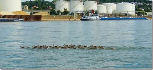
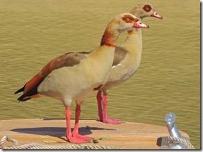
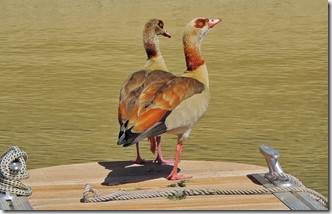
There are an incredible number of ducks, geese, and swans many with lots of fluffy babies. These pink legged birds look like they were created from left over parts of other water fowl. |
|
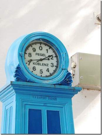
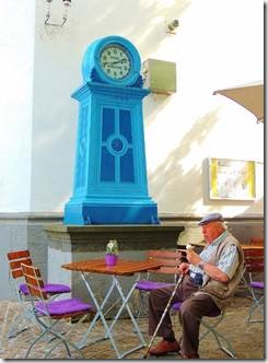
Depth Indicators A water depth of 172 centimeters is indicated by the Koblenz Pegel clock at that time and place sort of. Because you have to look on the chart at a specific location on the river and see how many centimeters to add to the pegel number for the real depth and you subtract the pegel number to tell you if you can fit under a bridge. The higher the pegel number, the higher the water level, in relation to the height of the bridge, the less space there is for you to fit under the bridge. Thank you Rick and Mary for the better explanations than all the Internet sites put together. |
|
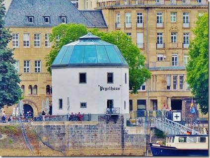
Pegelhaus Koblenz Here are the official and more complicated explanations of Pegel. In the upper reaches, at Kaub and Bingen water depth gauges (Pegelstände) have been set up to advise skippers of the actual depths on a daily basis. The current minimum depth of the river is displayed in centimetres, and the Pegelstände also broadcasts to skippers each day. (Note. A number of real time depth indicators for the Rhine and Mosel may be found on the internet or try www.loreley.de/vbglorel/kaub ) http://www.tradboat2.co.uk/sourcepages/rhineships/rhineships.htm Pegelhaus During the measures for fortification of the town of Koblenz under Elector Lothar of Metternich at the beginning of the 17th century, a Rhine Crane was erected for loading and unloading ships, which is the present day water gauge house. According to plans by the Jülich builder Johann Pasqualini a simple octagon construction with a profiled plinth was built between 1609 and 1611. The pilaster shows the date when it was completed (1611) on the ledge. With the expansion of the Moselle wharf, the crane house continued to lose importance. From 1819 to 1945 there was another ship’s bridge from the crane house to Koblenz-Ehrenbreitstein. After this, only the water gauge house was used. Next to the entrance to the present day restaurant, the highest water levels during the different centuries can be seen. The blue gauge clock is on the left. The berths for the tour boats are found in the direct vicinity of the gauge house along with the ferries to Ehrenbreitstein. http://www.koblenz-touristik.de Determination of equivalent water level The river bed is constantly being transformed by the effects of the current. This is a factor directly influencing the available water depth for vessel traffic in the navigation channel. The normal minimal water level during the period between 1839 and 1848 was able to be established within the framework of the CCNR. During that period, the discussions concerning the determination of water depth were carried out for a number of years in order to define the conditions for determining the water level. This model was used as the basis for the concept of equivalent water level (IW gleichwertiger Wasserstand), which has been measured and defined in regular intervals (1908, 1923, 1932, 1946, 1952, 1962, 1972, 1982, 1992, 2002). The equivalent water level will be re-determined in 2012 within the framework of the CCNR in order to accommodate the changes in the Rhine river bed. Determination of the equivalent water level takes place in three stages: •The reference water levels and an equivalent flow rate are defined •The water level at Cologne (Wasserstand der Pegel Köln) is determined •The water levels at other points are consequently determined In 1849, the Central Commission organised an inspection voyage from Basel to the sea with the aim of determining the actual and the required water depth. This practice was institutionalised by the Mannheim Convention, which specifies in Article 31: "From time to time hydraulics engineers delegated by the Governments of all the riparian States shall conduct surveys to examine the state of the river, to observe the results of measures taken for its improvement and to note new obstacles which impede navigation. The Central Commission (art. 43) shall designate the time and the parts of the river where these surveys are to be made. The engineers shall report to it on the results". Currently, the national authorities for waterway management are responsible for performing this inspection, and they present their report to the Committee for infrastructure and environment. Further information on equivalent water level can be obtained from Generaldirektion Wasserstraßen und Schifffahrt – Außenstelle West |
|
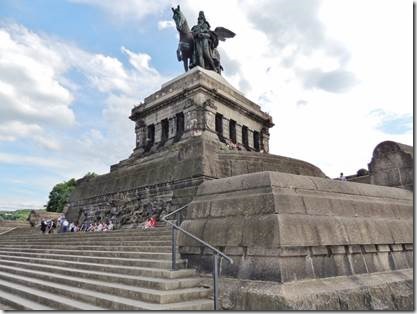
“……..the Deutsches Eck at the confluence of the Rhine and Moselle. In 1891 Kaiser Wilhelm II deemed this historic landmark, given its name by the knights of the Teutonic Order, the perfect site for a special monument. Here people could give thanks to his grandfather, Wilhelm I, the man who unified the German Empire. Alas, the statue was reduced to rubble in 1945, and in May 1953 Theodor Heuss, President of West Germany, declared the remaining plinth a poignant monument to German unity. Finally, in 1993, a replica of the statue was raised into position on the plinth, where it towers majestically over the two rivers at a height of 37 metres. Every year the impressive structure attracts more than two million visitors. Towering on the opposite side of the Rhine is Ehrenbreitstein, Europe’s second-largest preserved fortress. At nearly 120 metres above the river, this is the perhaps the best place to enjoy views of Koblenz.” http://www.germany.travel/en/towns-cities-culture/towns-cities/koblenz.html http://www.spiegel.de/ shows flood waters surround ng the statue. |
|
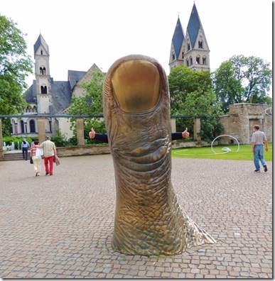
Where’s Randal? What better sculpture in the art museum plaza; Daniel Coulet’s Thumb http://www.ludwigmuseum.org/engl/exhibitions/current_coulet.htm |
|
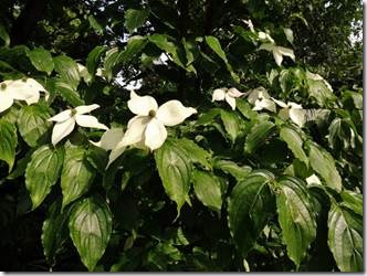
This reminded me of a Virginia Dogwood, our state tree. There is a variety with pointed petals called a Kousa Dogwood. |
|
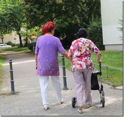
When I’m an old lady I shall wear purple…AND DYE MY HAIR RED! Maybe in lieu of a Red Hat. |
|
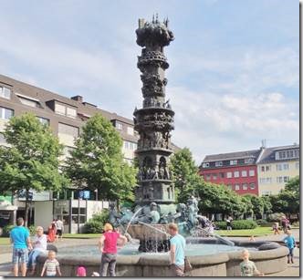
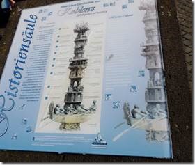
The Görres square is located in the heart of the old town, and is known for its historic fountain, presented by the federal state of Rheinland-Pfalz to the city of Koblenz in 1992, to mark the 2000-year-anniversary of the city. The column at the centre of the fountain is ten metres high, and depicts scenes from the city’s history, from the Roman beginnings to the present. http://www.cityhotel-koblenz.de/76.html Görresplatz Archaeological finds prove that the area around the present day Görres Square had been inhabited by the Romans. In the middle ages the square was the property of the Castor foundation and later, the Order of Jesuits. In the 19th century it continued to be constructed and was handed over to the town. The square which is called Görres Square today has also be known as the "Large Square" or „Parade Square“ and at the time of French occupation at the end of the 18th century it was also called "Place Verte". At the end of the 19th century, the area was named after General August von Goeben who also gained a memorial on the “Goeben Square“. Von Goeben was the commander general of the Koblenz VIII army corps for 10 years. After the Second World War, the square was "demilitarised" which means that the Goeben memorial was removed and the square was named after the Koblenz publicist and historian Joseph Görres. The fountain in the middle of the square with its 10m high historical columns is worth seeing. The artist Jürgen Weber tells the story of the town of Koblenz in 10 overlapping scenes presented three-dimensionally. |
|
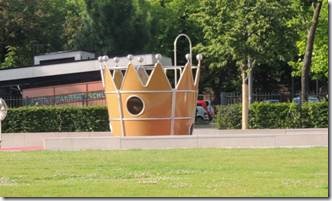
A play ground with a crown shaped play area. |
|
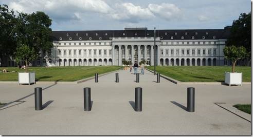
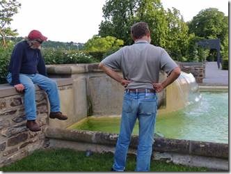
This ginormous place had lots of history but Randal and Rick were most interested in the fountain and I prefer ordinary people history to that of the rich and famous. |
|
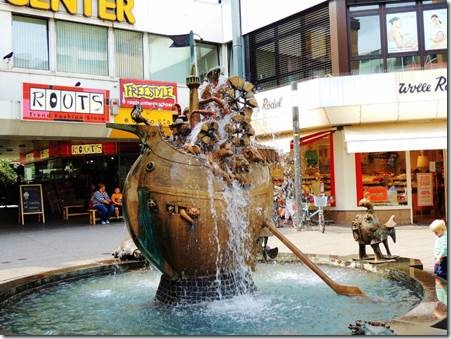
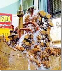
Noah’s Ark Koblenz. “The inventors fountain stands at the Löhr Center towards the pedestrian zone. In the middle of the well there is a boat. Noah’s Ark was probably the model here, because on the boat there are all sorts of animals. The fountain was created by the German sculptor Gernot Rumpf (* 1941). He is especially known for his fountains and statues with Palatine and biblical motifs, which can be seen in a number of German cities, as well as in Jerusalem and Tokyo.” There were moving parts and water shooting out from it. We saw a $ 1,000,000 Noah’s Ark amusement area being developed in Dordrecht. It had been built by a carpenter who dreamt the Netherlands would flood. |

