|
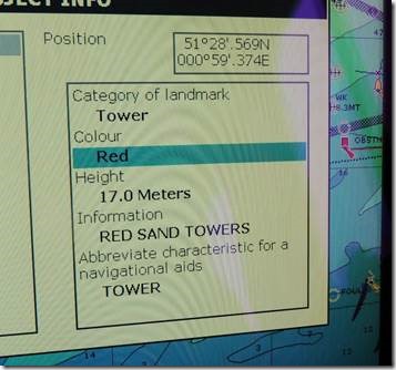
Red Sands Towers
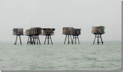
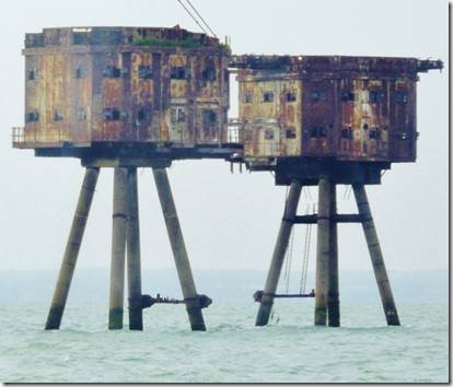
“At the outbreak of World War II, the Port of London was the busiest port in the world. As such, a large proportion of supplies to the UK entered by ships navigating the Thames. The German Navy quickly sought to put a stranglehold on this route, and to this end, utilised a new secret weapon – the magnetic influence mine. Whilst there were different variants of this mine, in simplistic terms, the mine was detonated by the presence of a large magnetic object – such as a steel hulled ship – passing in close proximity, without having to make physical contact.
So successful was this that in the first few months of the war, over one hundred ships were sunk in the Thames Estuary alone. It was clear that urgent action was needed to stem these losses, and as most mines were laid by aircraft, ships were requisitioned and used as mobile anti aircraft units. However, this was not altogether successful, and a more satisfactory solution was needed.In the early years of the war, Guy Maunsell, a civil engineer, had produced plans for offshore defences.
At the time his ideas were considered somewhat eccentric, but he was asked to submit plans for an offshore fort as an effective means of dealing with the laying of the mines. Plans were drawn up, and after some modification, approval was given for the manufacture and installation of four offshore forts. These were of mainly reinforced concrete construction, built on land on a lozenge shaped reinforced base, and towed out to sea where they were sunk onto the seabed.
Each fort accommodated approximately 120 men, housed mainly within seven floors of the 24’ diameter twin reinforced concrete legs. These forts were under the control of the Navy, and were individually known as HM Fort Roughs Tower, Sunk Head Tower, Tongue Sands, and Knock John. They were all placed in position between six and twelve miles offshore between February and June, 1942. They became operational immediately.In early 1941, Maunsell was contacted by the Admiralty to design defences in the Liverpool bay area of the Mersey. Seabed conditions dictated a different form of construction.
Each tower was built off a reinforced concrete base of ‘Oxford picture frame’ design. Four hollow reinforced concrete legs of 3’ diameter supported the 36’ x 36’ steel house of two floors, with the military equipment installed on the top deck. Each fort comprised seven towers linked by tubular steel catwalks. In addition to the Mersey forts, three forts of similar construction were built in the Thames estuary, between May and December, 1943. They were known as the Nore, Redsand and Shivering sands Army Forts.” http://www.project-redsand.com/history.htm tells the whole story.
“As with the other offshore platforms, after the war ended, pirate radio operators eagerly boarded the platforms and set up their tall transmitter masts – the configuration of the forts was ideal for such a construction.
First it was Radio Invicta, commencing on 29th July 1964, broadcasting from 6am to 6pm on 306m – the transmission times were limited as overnight transmissions would have been swamped out by a foreign radio transmitter using the same frequency. The station went off air in February 1965 and the fort was soon taken over by KING Radio, transmitting on 238m.
Then on 25th September 1965, Radio 390 took over with a more easy listening kind of programme – light jazz and Mantovani and his Orchestra could regularly be heard all over the south east of England on their 35KW transmitter. All stations were eventually closed in 1967 when the UK changed the law with regard to radio broadcasting.” http://subterrain.org.uk/maunsell/part4.html
|
|
Wreck of the Sir Richard Montgomery
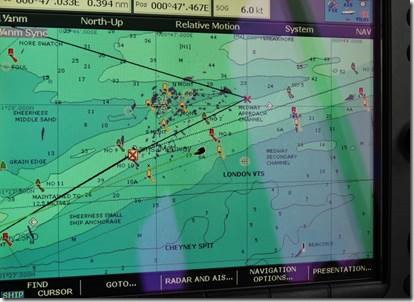
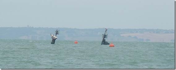
Wreck of the ammunition ship The Richard Montgomery forced a detour in the Medway
“‘We’re on a constant knife edge because of that thing out there,’ says David Robinson, 71, who has stopped to chat to me on the deserted promenade.
‘I’ve lived here all my life and not a day goes by when I don’t think about what will happen if that b***er blows.’
He points out to sea where, little more than a mile from the beach on which children still build sandcastles, the masts of a sunken ship can be seen jutting eerily above the waterline. Officially, this wreck is known as the SS Richard Montgomery but locals have another name for it . . .
When it sank in these waters towards the end of the World War II, the Montgomery was loaded with 7,000 tons of wartime bombs.
It’s estimated that anything from 1,400 to 3,000 tons of explosives are still packed in its water-logged hull, and it has been said that their detonation would cause one of the biggest non-nuclear explosions ever — 700 times the size of the bomb which claimed 168 lives in Oklahoma City in 1995.
One of nearly 3,000 ‘Liberty’ ships built in America to replace Allied cargo ships torpedoed by the Germans, she was part of a convoy due to be escorted from the Thames Estuary to France. On the morning of Sunday August 20, 1944 she was anchored off Sheerness when strong winds blew her perilously close to shallow water.
In the pre-dawn light, other ships in the area sounded their sirens in warning but she was soon grounded, her welded plates cracking and buckling with a loud bang as the tide dragged her to and fro. The 81 crew members were evacuated to nearby Southend and salvage work began — to save the bombs which were needed for the war effort, rather than the ship herself.
A team of stevedores got roughly half the explosives aboard back to shore but then, after five days, the ship broke in two and began to sink beneath the waves.
With the stevedores demanding danger money for their work, the Admiralty decided that retrieving any more bombs was too expensive.
Buoys and warnings signs were placed around the wreck and after the war it became as popular a tourist attraction as the resort’s band stand, amusement arcades and mini-golf…..
http://www.dailymail.co.uk/news/article-2195590/3-000-ton-timebomb-shipwrecked-Thames-estuary.html tells the complete story.
|
|
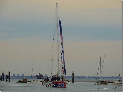
One of the racing ships coming in.
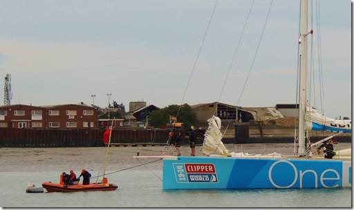
The Clipper 13-14 Round the World Yacht Race starts in London on 1 September 2013 and returns on 12 July 2014 – at 40,000 miles it’s the world’s longest ocean race.
It is the only race in the world where the organisers supply the fleet of twelve identical 70-foot, stripped down racing yachts – each sponsored by a place or a brand – and manned with a fully-qualified skipper, employed to lead crews safely around the globe.
The event was established by Sir Robin Knox-Johnston to give everyone, regardless of sailing experience, the opportunity to discover the exhilaration of ocean racing. https://www.clipperroundtheworld.com/about
|

